|
Short articles about the original "West Dallas" area, briefly also called "Mount Airy"
|
|
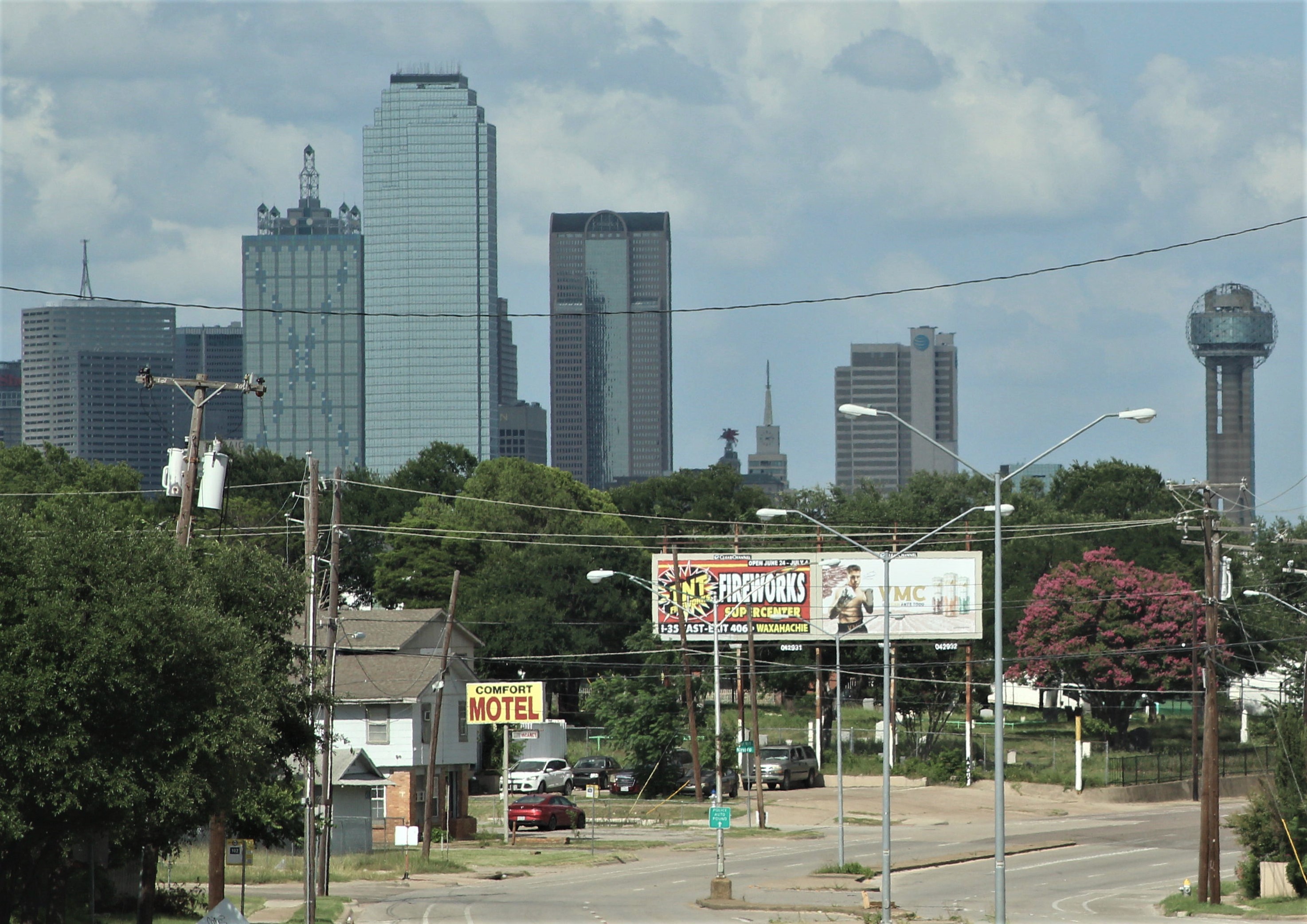
View toward downtown Dallas from the southwest corner of the William Coombes Survey, along Fort Worth Avenue, with the Western Heights Cemetery. 
The William Coombes Survey is a square mile (two half-sections of the 1840s' Peters Colony grid system) located about 2 miles west-southwest of the "Old Red" Courthouse in downtown Dallas. [street map c.2025] (click on map to enlarge) |
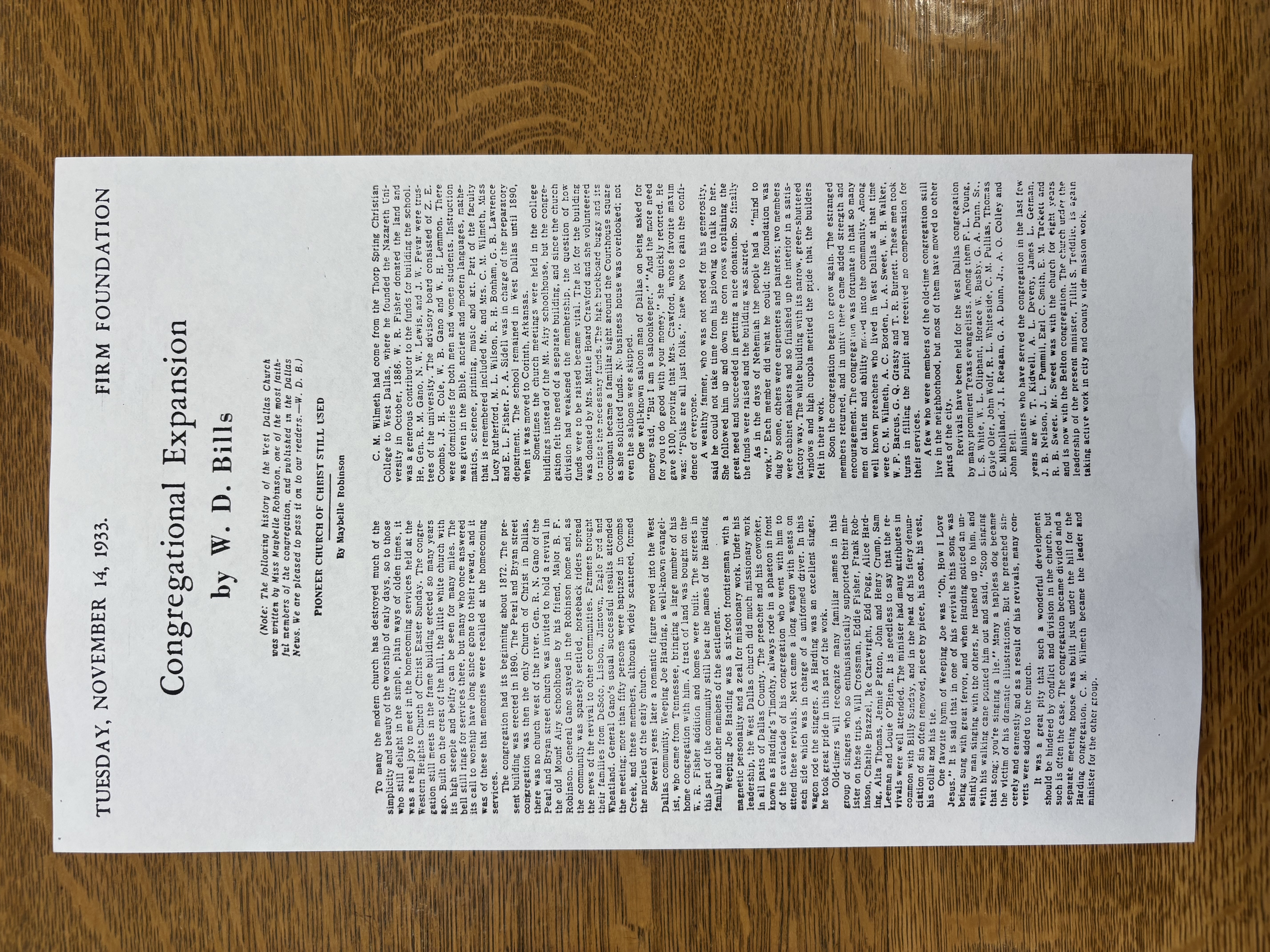
Regarding the whole William Coombes Survey: Articles are about the entire square mile area of Willliam Coombes' land grant. Mabel Gilbert's cabin The first Dallas cabin on the west side of the Trinity River, built by Mabel and Charity Gilbert. Genealogy of William Coombes Listing of all the members of the large family of William Nelson Coombes (1803-1867). William Coombes in Texas Biography of the life of William Nelson Coombes (1803-1867) and his family in Texas. The Bois D'arc Corral History of the thorny bois d'arc corral William Coombes created to stop Indians from stealing horses. The 1855 Cabin Map Early La Reunion colonists' map, showing every structure. Land Ownership: 1842-1908 Series of maps showing subdivision of the area's real estate. Street Names 2026 list with histories about the names of all the streets in the William Coombes Survey. CEMETERIES: Articles about cemeteries in, or near, the William Coombes Survey. Western Heights Cemetery These articles supplement this cemetery's main webpage, linked to its name above. Missing Burials List of possibly unmarked Coombes family related burials. Ownership Map showing the history of land title transfer at the cemetery. Boundary Map comparing deeded boundaries with modern boundary and fences. The SouthEast Corner Deed records suggest something previously occupied the southeast corner. Struck Cemetery Inside the southeast corner of Western Heights Cemetery Scott Family Cemetery A little pioneer family cemetery. now moved away to a safer location Robinson Family Cemetery A little cemetery containing ten Robinson family burials Robinson Family History 1980 genealogical and historical account of the Robinsons Notes on the Robinson Family History Minor corrections proposed for the 1980 history SCHOOLS: Articles about various schools in, or near, the William Coombes Survey. Mount Airy Academy Neighborhood public school and community center --c.1874-1895 National Christian College The first black college in Dallas Nazareth University A college at the top of the hill Cedar Valley--Benito Juarez School A longtime school site on Singleton Fred Douglass In the 1890s the first school for African Americans in West Dallas was opened West Dallas Public School A three story brick school built in 1894 District map West Dallas school district areas, showing 1891 City of Oak Cliff St. Mary of Carmel Roman Catholic complex including both church and school CHURCHES: Articles about various churches in, or near, the William Coombes Survey. West Dallas Church of Christ 1872-1985, also known as Western Heights Church of Christ. Mabelle Robinson's 1933 history Sue Churchill Krayer's 1987 history Presbyterian church site 1886 site acquisition for a congregation who never built there. West Dallas Methodist Episcopal Church 1888-1948 Methodist congregation West Dallas Baptist Little known early Baptist church and a 1917-c.1980 congregation Mt. Gilead Baptist & Carter Temple C.M.E. Two colored congregations -- before 1896 |
|
Jim Barnes Barnes444@sbcglobal.net |
|